Density
changes obtained two-dimensional modeling
|
 |
GEOCHEMISTRY |
 |
Soil
and soil-air surveys (Mercury, Carbon Dioxide, and Carbon-13,etc.)
|
|
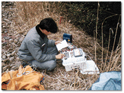
Sampling
including chemical and isotopic analyses of geothermal
fluids from geothermal wells and surface features |
|
Geochemical
interpretation addressed to disclose the origin, subsurface
temperature, chemical characteristics, fluid behaviour,
etc. of geothermal fluids |
|
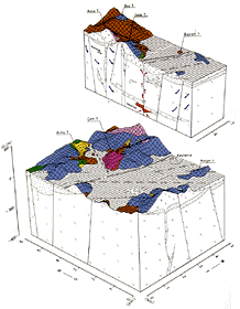
Construction
of geochemical models, including mixing features and
flow patterns |
|
Prediction
of scale deposition and corrosion from chemical studies
of geothermal fluids |
|